Research Article - Journal of Agricultural Science and Botany (2021) Volume 5, Issue 12
Assessment of Rangelands in Protected and Grazed areas at Zalingei area, Central Darfur State, Sudan
Abdelrahim Omer Abdelrahim1, Mulik Abbaker Ibrahim*1,2, Mohammed Abdelmanan2
1Department of Range, College of Forest Sciences, University of Zalingei, Sudan
2Department of Forestry, College of Forest Sciences, University of Zalingei, Sudan
- *Corresponding Author:
- Mulik Abbaker Ibrahim
Department of Range College of Forest Sciences University of Zalingei Sudan
E-mail: mulikabaker@yahoo.com
Accepted on December 17, 2021
Abstract
The study was conducted at Zalingei areas, Central Darfur State, Sudan. During rainy season in 2018 to assess the vegetation attributes in the protected and grazed sites at rangelands. The vegetation attributes which were measured by Parker Loop Method included plant composition%, plant relative composition%. Quadrat Method was used to determine frequency% and biomass production. Carrying Capacity was calculated depend on biomass production. The standard equations were used to analyse the data of vegetation attributes which were mentioned in part (2). The protected site was showed higher values of plant litters and bare soil respectively (24.83 and 23.16%) than grazed site (19.5% and 15.16%). The dominant species in the protected site most of them belong to grasses, included Aristida fanculata, Eragrostis spp, Aristida mutablis, Scheonfeldia gracilis and Zornia glochidiata and the dominant species in the grazed area included Aristida fanculataI, Zornia glochidiata, Oldenlandia senegalensis, Dactyloctenium aegyptium and Scheonfeldia gracilis, the dominant species in the protected area most of them are grasses. In the grazed area most of dominant species were forbs and considered unpalatable for livestock in the study area. The research recommended the protection of rangelands has benefits to rest plants from grazing process, particularly at early rainy season. The study was conducted at Zalingei areas, Central Darfur State, Sudan. During rainy season in 2018 to assess the vegetation attributes in the protected and grazed sites at rangelands. The vegetation attributes which were measured by Parker Loop Method included plant composition%, plant relative composition%. Quadrat Method was used to determine frequency% and biomass production. Carrying Capacity was calculated depend on biomass production. The standard equations were used to analyse the data of vegetation attributes which were mentioned in part (2). The protected site was showed higher values of plant litters and bare soil respectively (24.83 and 23.16%) than grazed site (19.5% and 15.16%). The dominant species in the protected site most of them belong to grasses, included Aristida fanculata, Eragrostis spp, Aristida mutablis, Scheonfeldia gracilis and Zornia glochidiata and the dominant species in the grazed area included Aristida fanculataI, Zornia glochidiata, Oldenlandia senegalensis, Dactyloctenium aegyptium and Scheonfeldia gracilis, the dominant species in the protected area most of them are grasses. In the grazed area most of dominant species were forbs and considered unpalatable for livestock in the study area. The research recommended the protection of rangelands has benefits to rest plants from grazing process, particularly at early rainy season.
Keywords
Plant litters, bare soil, plant composition, frequency, relative frequency, dominant species
Keywords
Flexibility of animal movement is progressively hampered by increased population pressure and loss of corridors between wet and dry season grazing areas. Stock is increasingly concentrated the entire year on the same lands, breaking the ecologically sound cycle of alternating use of wet and dry season grazing areas, leading to over-use of dry season grazing land and, inevitably, to human suffering [1]. Plant consumption by herbivores introduces an additional feeding level between the primary producers and decomposers, but the question is how grazing influences energy flow and nutrient cycling within ecological systems. An ecological dilemma the percentage of annual above-ground primary production utilized by herbivores varies greatly, but estimated generally range between 20 to 50% [2]. Although much higher levels of utilization can occur in excess of 90%, they are generally restricted to specific regions or years. An even smaller portion of total annual primary production is utilized by domestic herbivores, because approximately 60 to 90% occurs below-ground in grassland systems [3]. Rangelands are highly susceptible to the impacts of climate change in response to limited water availability and higher air and soil temperatures [4]. Impacts on rangeland vegetation include reduced growth rates, lower photosynthetic rates, impaired mineral absorption, low tissue regeneration and increased concentrations of secondary metabolites such as ginsenosides and polyphones [5].
Rangelands are the home to millions of people, most of who rely solely on the ecological services that rangelands provide. The significance of rangelands as a resource base falls into several broad categories: for grazing animals, livestock and wildlife; for biodiversity conservation: as a source of medicinal plants and foods; for carbon sequestration; as a reservoir of irreplaceable biodiversity and as a bastion of customs and tradition that have endured for centuries. Therefore, this study aims to assess plant characteristics (plant composition, frequency, ground cover, productivity) in the protected and open grazing sites in preparation for use of fencing system in management of natural rangeland.
Materials and Methods
The study area: Zalingei locality, lies between latitude 12° 30' - 13° 30''N and longitude 30° 23' - 45° 23''E [6]. The study is carried out at Zalingei area which located between latitude 12° 42' 576'' N ( South point) and 13° 08' 055'' N (North point) and between longitude 23° 39' 761'' E (East point) and 23° 25' 835'' E (West point), with altitude varies from 890 m to 1121 m above the sea level. Characterized by varying temperatures between 26-38c°, and the average annual rain about 800 mm and relative humidity up to 83% in the rainy season (Figure 1).

Figure 1. Showed the study area.
Sampling procedures
The data of the research gathered from two sites each one ½ km2 first site was protected from grazing operation, and second site open for grazing presented Three transect length 100m were layout in each site and Three quadrats distributed along each transect to come up nine quadrat of site and 18 quadrat for all study area.
Measurements of vegetation attributes
Plant composition
Parker loop method [7] was used. A total of 100 hits per transect were taken, then distribution of the species, litters, bare soil and rocks along each transect were identified. The following equations were used to calculate per cent of certain parameters such as (Plants composition%, relative plants species composition%, litter%, bare soil% and rocks %)


Frequency
Three quadrats per line transect at interval of 100 m from 500m length that give Nine quadrat per site and (18) quadrat in the study area. To estimate plant distribution.
Plant frequency was calculated by counting species, which occur within each quadrat and recorded their names only. The following equation was used to calculate frequency [8].

Plant cover
According to [9]. Plant cover percentage usually estimated by looking at the quadrat from the above and estimate approximately the part covered by plants for each quadrat and recorded in form of plant cover %. The total cover for all quadrats determined total cover for each site, which is divided by the number of quadrats taken in each site to obtain one average. The following equation was used to calculate plants cover%.

Biomass production and carrying capacity
Sampling was done by locating a1/2 km2 plots in both sites open rangeland and protected rangeland. In each plot, three transects of 500m length were constructed, at each of the transect, three quadrates of one m2 were selected, giving a total number of 18 quadrats. Samples were cut in grazing level 3cm, labelled and then oven dried at105C° for 24 hours and their dry weight recorded [10]. Then the dry matter (ton per hectare) was used following formulas.
 (6)
(6)
 (7)
(7)
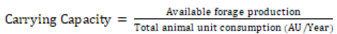
The carrying capacity was calculated according to the daily requirement of a Tropical Livestock Unit (TLU) 2.5 – 3% of their body weight. And proper use factor is (0.5) which is equivalent to (7.5 kg/day) as reported by [11]. Carrying capacity was calculated as follows:
 (8)
(8)
Results and Discussion
Parker loop measurements (plant composition%, Litters%, Bare soil% and Rocks %)
Plant composition in the two sites recorded similar values in protected area was 14.51% and in grazed area 42.68%. Protected area recorded higher plant litters per cent (24.83%) than grazed area (19.5%), which might due to repeated grazing in the grazed area on short time within rainy season in addition to early grazing. The value of bare soil in the protected area was higher (23.16%) than in grazed area (15.16%) that due to high plant composition in this site and rocks per cent was high in grazed area (22.66%) and in protected area (10.5%) (Table 1).
| Parameters | Protected | Grazed |
|---|---|---|
| Plant composition % | 41.51 | 42.68 |
| Litters % | 24.83 | 19.5 |
| Bare soil % | 23.16 | 15.16 |
| Rocks % | 10.5 | 22.66 |
| Total | 100 | 100 |
Table1. Percent cover for two range sites.
Relative Plant Composition in the two sites
In the protected area the species recorded high plant composition per cent were included Aristida mutablis (26.89%), Aristida fanculata (14.82%) and Eragrostis spp (12.43%) and other species appeared in small per cent illustrated in (Table 2). The species in the grazed area included Aristida fanculata (67.54%), Eragrostis spp (13.66%) and Aristida mutablis (8.58%) and other species recorded in (Table 2). There no variation between the two sites in the relative plant composition per cent.
| No | Scientific name | Local name | PC/ Protected site | PC%/ Grazed site |
Habits |
|---|---|---|---|---|---|
| 1 | Aristida abisinis | Gaw abid | 0.39 | 0.37 | Grass |
| 2 | Aristida mutablis | Gaw azrag | 26.89 | 8.58 | Grass |
| 3 | Schizachyrium exile | Gaw ahmer | 14.82 | 67.54 | Grass |
| 4 | Hetropogon contortus | Abuherab | 2 | 0 | Forbs |
| 5 | Eragrostis tremula | Banw | 12.43 | 13.66 | Grass |
| 6 | Justicia schimperi | Umderademat | 0.79 | 0.37 | Forbs |
| 7 | Senna obtusifolia | Kawal | 3.61 | 1.55 | Forbs |
| 8 | Oldenlandia senegalensis | Tamer el far | 4.4 | 0.77 | Forbs |
| 9 | Seasabania seasaban | Sorabi | 2 | 0.37 | Forbs |
| 10 | Dactyloctenium aegyptium | Abuasabi | 10.43 | 0.77 | Grass |
| 11 | Oxygonum atriplicifolium | Um hamed | 0.39 | 0 | Forbs |
| 12 | Ipomoea belpharosepla | Hantoot | 1.2 | 0 | Forbs |
| 13 | Sesbania arabic | Sesban | 2.4 | 0 | Forbs |
| 14 | Zornia glochidiata | Sheliniy | 2.4 | 1.55 | Grass |
| 15 | Indigofera hochstetteri | Sharaya | 1.59 | 0 | Forbs |
| 16 | Schoenfeldia gracilis | Danabelnaga | 1.2 | 1.17 | Grass |
| 17 | Justica kotschyi | Nana | 1.79 | 1.37 | Forbs |
| 18 | Corchorus olitorius | Molukhia | 0.39 | 0 | Forbs |
| 19 | Chloris gayana | Afanelkhadeem | 1.2 | 0 | Grass |
| 20 | Pennisetum pedicellatum | Umdofofo | 2 | 1.55 | Grass |
| 21 | Cenchrus biflofrus | Haskaneet | 0.39 | 0 | Grass |
| 22 | Alycicarpus vaginalis | Kasbera | 0.39 | 0 | Forbs |
| 23 | Aristida adscensionis | Um hribo | 4.82 | 0 | Grass |
| 24 | Vigna sun-hum | Taktag | 0.39 | 0.37 | Forbs |
| 25 | Oldenlandia herbacea | Gragoub | 0.39 | 0 | Forbs |
| 26 | Polycarpea corymbosa | Ras elshibe | 1.59 | 0 | Forbs |
| 27 | Xanthium brasilicum | Ramtok | 0 | 0.37 | Forbs |
| 28 | Abutilon angulatum | Mgshat elregal | 0 | 0.37 | Forbs |
| Total | 100 | 100 | |||
Table 2. Relative Plant Composition (%) at the two Range sites during season 2018.
Frequency and Relative Frequency in the two sites
The species Aristida fanculata was recorded highest frequency in both sites protected site and grazed site (77.8 and 100%) respectively, Eragrostis spp (66.7%) in protected area and Zornia glochidiata (88.9%) in grazed area, Aristida mutablis, Dactyloctenium aegyptium were recorded same value (44.4%) in the two sites (Table 3).
| No | Scientific name | Local name | Protected area | Grazed area | Habits | ||
|---|---|---|---|---|---|---|---|
| Frequency % | Relative Freq% |
Frequency % | Relative Freq% |
||||
| 1 | Aristida abisinas | Gaw abid | 22.2 | 3.7 | 11.1 | 1.75 | Grass |
| 2 | Aristida mutablis | Gaw azrag | 44.4 | 7.4 | 22.2 | 3.57 | Grass |
| 3 | Schizachyrium exile | Gaw ahmer | 77.8 | 12.98 | 100 | 16.08 | Grass |
| 4 | Hetropogon contortus | Abuherab | 22.2 | 3.7 | 0 | 0 | Forbs |
| 5 | Eragrostis tremula | Banw | 66.7 | 11.12 | 33.3 | 5.36 | Grass |
| 6 | Senna obtusifolia | Kawal | 22.2 | 3.7 | 33.3 | 5.36 | Forbs |
| 7 | Oldenlandia senegalensis | Tamrelfar | 33.3 | 5.55 | 44.4 | 7.14 | Forbs |
| 8 | Sesbania seasaban | Sorib | 22.2 | 3.7 | 33.3 | 5.36 | Forbs |
| 9 | Dactyloctenium aegyptium | Abu asabi | 44.4 | 7.4 | 44.4 | 7.14 | Grass |
| 10 | Oxygonum atriplicifolium | Um hammed | 11.1 | 1.85 | 0 | 0 | Forbs |
| 11 | Ipomoea belpharosepla | Hantoot | 22.2 | 3.7 | 22.2 | 3.57 | Forbs |
| 12 | Seasabania arabic | Seasaban | 11.1 | 1.85 | 0 | 0 | Forbs |
| 13 | Zornia glochidiata | Shillini | 33.3 | 5.55 | 88.9 | 14.3 | Grass |
| 14 | Indigofera hochstetteri | Sharaya | 11.1 | 1.85 | 11.1 | 1.775 | Forbs |
| 15 | Schoenfeldia gracilis | Danabelnaga | 44.4 | 7.4 | 44.4 | 7.14 | Grass |
| 16 | Justica kotschyi | Nana | 11.1 | 1.85 | 22.2 | 3.57 | Forbs |
| 17 | Corchorus olitorius | Molukhia | 0 | 0 | 11.1 | 1.75 | Forbs |
| 18 | Pennisetum pedicellatum | Umdofofo | 0 | 0 | 11.1 | 1.75 | Grass |
| 19 | Cenchrus biflofrus | Haskaneet | 11.1 | 1.85 | 0 | 0 | Grass |
| 20 | Vigna sun-hum | Tagtag | 22.2 | 3.7 | 0 | 0 | Forbs |
| 21 | Oldenlandia herbacea | Gragoub | 22.2 | 3.7 | 0 | 0 | Forbs |
| 22 | Polycarpea corymbosa | Ras elshibe | 11.1 | 1.85 | 22.2 | 3.57 | Forbs |
| 23 | Commicarpus africanus | Lesage | 22.2 | 3.7 | 11.1 | 1.75 | Forbs |
| 24 | Stylosanthes fruticosa | Natasha | 11.1 | 1.85 | 0 | 0 | Forbs |
| 25 | Blepharis linariifolia | Beg hail | 0 | 0 | 22.2 | 3.57 | Forbs |
| 26 | Senna occidentalis | Aboefeen | 0 | 0 | 11.1 | 1.75 | Forbs |
| 27 | Sida cordofolia | Nada | 0 | 0 | 11.1 | 1.75 | Forbs |
| 28 | Dicanthium annulatum | Um melaha | 0 | 0 | 11.1 | 1.75 | Grass |
| Total | 599.6 | 100 | 621.8 | 100 | |||
Table 3. Plant Frequency and Relative Frequency in study area.
Five dominant species in the two sites
The protected area was dominated with Aristida fanculata , Eragrostis spp, Aristida mutablis, Scheonfeldia gracilis and Zornia glochidiata and the dominant species in the grazed area included Aristida fanculataI, Zornia glochidiata, Oldenlandia senegalensis, Dactyloctenium aegyptium and Scheonfeldia gracilis, the dominant species in the protected area most of them are grasses, that might due to protection of area which encourage plants to sets seeds for a long time. In the grazed area most of dominant species belong to forbs and considered unpalatable for livestock in the study area, that due to early grazing and intensive grazing (Table 4).
| No | Sites | |||
|---|---|---|---|---|
| Protected | Habits | Grazed | Habits | |
| 1 | Aristida fanculata | Grass | Aristida fanculataI | Grass |
| 2 | Eragrostis spp | Grass | Zornia glochidiata | Forbs |
| 3 | Aristida mutablis | Grass | Oldenlandia senegalensis | Forbs |
| 4 | Scheonfeldia gracilis | Grass | Dactyloctenium aegyptium | Grass |
| 5 | Zornia glochidiata | Forbs | Scheonfeldia gracilis | Grass |
Table 4. Five dominant species in the two sites.
Biomass production in the two sites
The biomass production was recorded low values in both sites protected and grazed area (870 and 491.16kg/ha) respectively, that could be due to intensive, early grazing in the area and harvesting for grasses by people in the area to provide forage for their livestock in the dry season and that effects on carrying capacity (Table 5).
| Parameters | Sites | |
|---|---|---|
| Protected area | Grazed area | |
| Biomass gm/m2 | 87.49 | 49.12 |
| Biomass kg/m2 | 0.087 | 0.049 |
| Biomass kg/ha | 870 | 491.16 |
Table 5. Biomass production at the two sites.
Conclusion and Recommendations
The study calculated that is protected site was recorded higher values of plant litters than grazed site and the most dominant species in this site were annual grasses, while in grazed site the species were forbs and most of them unpalatable for livestock in the study area. The study recommended that the application of protection for rangelands before actual grazing (rest) leads plants to re growth in fast time and increasing the biomass production and lead the plants to complete growth.
References
- Coppock DL. The Borana plateau of southern Ethiopia: Synthesis of pastoral research, development and change. ILCA, Addis Ababa. 1994:374.
- Scott, Detling. An Ecological Perspective. Grazing management An Ecological Perspective. 1979;7.
- Sims, Singh, Stanton (1988). An Ecological Perspective. Grazing management An Ecological Perspective. 1988;7.
- Belgacem AO, Louhaichi M. The vulnerability of native rangeland plant species to global climate change in the West Asia and North African regions. Climatic Change.2013;119(2):451-63.
- Jochum GM, Mudge KW, Thomas RB. (2007). Elevated temperatures increase leaf senescence and root secondary metabolite concentrations in the understory herb Panax quinquefolius (Araliaceae). Am J Bot. 2007;94(5):819-26.
- Hadi II. Agricultural potentials and means of development in Jebel Marra region of Sudan. A study in agricultural geography submitted to the council 96 of the faculty of arts, University of Albissra in partial fullfillment to the requirements of doctor of philosophy in geography. 2004.
- Parker KW, Harris RW. The 3-step method for measuring condition and trend of forest range: a resume of it is history, development and use. In: techniques and methods of range measurement. 1959.
- Daubenmire R. Plant communities. A textbook of plant synecology. Plant communities. A textbook of plant synecology. 1968.
- Kent M, Coker P. Vegetation Description and Analysis. A practical approach. Belhaven Press. London. 1992:363.
- Gaiballa AK. Natural Range practices and concepts (in English language). Press of Sudan University of Science and Technology (SUST). (edIst), Khartoum, Sudan. 2014.
- Mustafa H, Elgoni O, Mohammed A. Manual for range improvement and management, DHP publication. 2000.